The International Semester – Shore Management at BUILDERS École d’Ingénieurs is an advanced programme for civil engineering students who wish to specialise in the integrated management of shorelines, estuaries and port areas in a context of climate change and increasing coastal risks.

The semester is taught in English and is built on a deliberately multidisciplinary approach: coastal and river hydraulics, inland waterways and dredging, numerical and data tools for the coast, advanced design of coastal structures and sustainable coastal development. It takes place in autumn, from October to March.
This programme aims to train engineers able to:
· Understand coastal and river hydraulic processes in order to analyse currents, waves, water levels and their effects on rivers, estuaries and coastal zones (Hydraulics, Inland Waterways and Dredging).
· Design and verify coastal and river protection structures, integrating stability, durability and safety of infrastructures (Advance design structure for coastal engineering).
· Use data and digital tools for coastal developments, including GIS, numerical models and digital twins for shoreline infrastructures (Data and Numerical Tools for Shore and coastal Works).
· Analyse and manage coastal development projects, taking into account planning, environmental, risk and shoreline-use issues (Coastal Development).
· Work on integrated case studies combining hydraulics, geotechnics, structural design and project management, and prepare for the continuation of the Master’s trajectory and MSc thesis.
· Complement these courses with an international Summer School on Offshore and Coastal Infrastructures, with advanced modules on caisson breakwaters, environmental impacts, flood risk, offshore wind design, soil improvement and cable trenches.
· A specialisation focused on shoreline management at the crossroads of hydraulics, geotechnics, maritime works and coastal planning.
· A strong digital component, with a full course unit dedicated to Data and Numerical Tools for Shore and coastal Works (GIS, simulation tools, digital twins) directly linked to current practices of engineering offices and port authorities.
· A learning environment connected to a maritime laboratory, allowing lectures to be illustrated by wave flume demonstrations, in-situ measurements and case studies derived from real projects.
· International exposure through the CoMEM+ partnership and lecturers from foreign universities and organisations involved in coastal engineering and integrated coastal zone management.
· Project- and case-based pedagogy that directly prepares students for their MSc thesis and future responsibilities in design, management or project ownership.
· Participation in the Summer School “Marine Transport and Renewable Energy”, organised with academic partners: four intensive weeks of specialised modules (caisson breakwaters, environmental impacts, offshore wind, soil improvement, submarine cables, etc.) that enrich students’ CVs and strengthen their professional network.
Prerequisite
Basic concepts in fluid mechanics, wave science, and mathematics applied to engineering.
Course Description
This course provides advanced theoretical, numerical, and experimental tools for wave mechanics, sea levels, and hydraulic processes relevant to coastal and port engineering. Emphasis is placed on wave propagation, port agitation, numerical wave flumes and physical modelling with direct applications to maritime structures.
Course topics
· Wave analysis and propagation in coastal environments
· Port agitation and wave–structure interaction
· Numerical wave flumes and experimental modelling
· Sea-level variability and tidal analysis
· Hydraulic laboratory experiments applied to coastal engineering
Learning outcomes
Students will be able to:
· Apply advanced wave theories to analyse wave propagation and transformation and use them as design data for coastal and port structures.
· Analyse wave–structure interactions and agitation in harbours in relation to operational and safety criteria.
· Model free-surface flows and waves in numerical flumes to support structure design.
· Integrate extreme sea levels, tides and surges into design.
· Design, conduct and interpret hydraulic laboratory tests and measurement campaigns.
· Process and communicate experimental and numerical data at an engineering level.
Course content (modules)
· Nearshore wave modelling (12 h)
· Free surface flow modelling (15 h)
· Wave agitation modelling (6 h)
· Wave agitation for port (3 h)
· Sea levels (6 h)
· Numerical wave flume (24 h)
· Experimental modelling of coastal and port structures (3 h)
· Hydraulic laboratory practical (12 h)
· Wave flume wave analysis (6 h)
· Design wave conditions (3 h)
· Design of hydraulic infrastructure (9 h)
· Technics of measurements (6 h)
· Harbour and basin gates (6 h)
Teaching format
Lectures, tutorials, numerical modelling exercises, hydraulic laboratory sessions, and a short applied project on coastal/port engineering.
Assessment methods
Continuous assessment (laboratory work, participation) and final project report (Wave Project).
Teaching staff
Luc Hamm, Mohammad Saud Afzal, Franck Mazas, Jérôme Marinier, Ali Mahdi, Iman Safari, Gaëtan Dufour, Florence Gandilhon, Maria Lourdes Jalon Ramirez, Jean-Baptiste Richon.
Prerequisite
Basic knowledge of hydraulics, open-channel flow, sediment transport, and applied mathematics for engineering.
Course Description
Engineering principles and professional practices related to inland waterways, dredging operations, and sediment management, combining hydraulic theory, design methodologies, environmental aspects and case studies.
Course topics
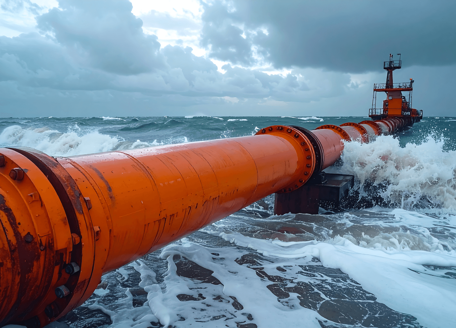
· Dredging techniques and equipment
· Hydraulic pumping and penstock pipes
· Inland waterways design
· Layout and environmental choice
· Layout and navigation
· Layout application exercises
· Sediment transport
· Sediment transport modelling
Learning outcomes
Students will be able to:
· Analyse and plan dredging operations (techniques, equipment, productivity, constraints).
· Design pumping and hydraulic transport systems for sediments.
· Design inland waterways compliant with hydraulic and nautical requirements.
· Integrate environmental and regulatory constraints into inland waterway projects.
· Assess navigation conditions and safety.
· Analyse solid transport processes and use related models for engineering decisions.
Course content (modules)
· Dredging (18 h)
· Hydraulic Pumping and Penstock Pipes (6 h)
· Inland Waterways Design (18 h)
· Layout and Environmental Choice (6 h)
· Layout and Navigation (6 h)
· Layout Application (3 h)
· Sediment Transport (9 h)
· Sediment Transport Modelling (6 h)
Teaching format
Lectures, tutorials, numerical modelling and short applied project on inland waterways or dredging.
Assessment methods
Continuous assessment (assignments, practical exercises, participation) and final applied project or technical report.
Teaching staff
Myriam Abou-Habib, Dominique Mouaze, Bertrand Marsset, Jean-Michel Hiver, Piero Silva, Arthur Lopez.
Prerequisite
Basic knowledge of coastal processes, numerical modelling, data analysis, and GIS concepts.
Course Description
Advanced data-driven, numerical and digital tools applied to shoreline and coastal engineering: AI, digital twins, remote sensing, photogrammetry and case studies to support coastal management and decision-making.
Course topics
· AI for Shore Management
· BIM and Digital Twin for Maritime Infrastructure
· GIS – Shoreline Application
· Photogrammetry for Maritime Infrastructures
· River and Marine Digital Twin
· Satellite Data for Shore Management
· Shore Management
· Case Study of Mont-Saint-Michel
· Shore Management
· Shore Risks
· Shoreline Monitoring
Learning outcomes
Students will be able to:
· Use AI methods to analyse shoreline data and predict coastal evolution.
· Implement BIM and digital twins for coastal and maritime infrastructures.
· Exploit GIS and satellite data for spatial analysis and shoreline monitoring.
· Apply photogrammetry to the surveillance of coastal structures.
· Develop digital twins of river and coastal systems.
· Design shoreline-monitoring strategies and coastal risk-management approaches illustrated by case studies such as Mont-Saint-Michel.
Course content (modules)
· AI for Shore Management (6 h)
· BIM and Digital Twin for Maritime Infrastructure (6 h)
· GIS – Shoreline Application (6 h)
· Photogrammetry for Maritime Infrastructures (6 h)
· River and Marine Digital Twin (10 h)
· Satellite Data for Shore Management (6 h)
· Shore Management (9 h)
· Case Study of Mont-Saint-Michel (8 h)
· Shore Risks (3 h)
· Shoreline Monitoring (9 h)
Teaching format
Lectures, études de cas appliquées, retours d’expérience professionnels, travaux de groupe et analyses stratégiques.
Assessment methods
Continuous assessment (assignments, practical exercises, participation) and final applied project or technical report.
Teaching staff
Saud Afzal, Ross O’Connell, Luc Hamm, Marc Igigabel, Romain Rasse, Yoann Bonte, Bernadette Tessier, Aurélie Le Dissez.
Prerequisite
Fundamentals of hydraulics and wave mechanics, basics of soil mechanics and foundation engineering, core concepts in coastal engineering (nearshore waves, water levels, sediment transport).
Course Description
Advanced expertise in the design of coastal and port structures, with strong focus on reliability-based design, climate-change adaptation, hybrid defences, scour, monitoring and advanced numerical tools, structured around an integrated design workshop.
Course topics / Course content
1. Coastal Structural Reliability and Design Basis (9 h)
2. Structural Design for Climate-Change Adaptation and Hybrid Defences (9 h)
3. Scour and Seabed–Structure Interaction (9 h)
4. Structural Health Monitoring and Asset Management for Coastal Infrastructure (9 h)
5. Advanced Numerical Modelling of Coastal Structures (12 h)
6. Integrated Design Workshop – Coastal Protection Scheme (12 h)
Learning outcomes
Students will be able to:
· Apply limit-state concepts, load combinations and safety factors to the design of coastal and port structures.
· Assess the impact of climate change on structural demand and safety margins.
· Analyse scour risk and soil–structure interaction.
· Specify and interpret monitoring systems for coastal asset management.
· Use advanced numerical models to support design.
· Develop an integrated coastal-protection solution within a design project.
Teaching format
· Lectures with engineering examples
· Tutorials and calculation exercises (individual and group)
· Use of FEM and wave–structure modelling tools
· Design workshop and oral presentation
Assessment methods
Integrated design project and written exam.
Teaching staff
Geoffroy Caude, Esteban Escobar Valencia, Jean-Bernard Kovarik, Yabal Seye, Behnam Ghadimi, Patricia Enet.
Prerequisite
Basic knowledge of coastal engineering, environmental sciences, and applied statistics.
Course Description
Coastal development and management integrating engineering, environmental, regulatory and logistical dimensions, with a focus on sustainable coastal infrastructures, risk management and climate-change adaptation.
Course topics
· Adaptation of Maritime Works to Climate Change (9 h)
· Biodiversity Management in Marine Infrastructures (4 h)
· Building with Nature / Human Impact Assessment (12 h)
· European Legislative Framework for Marine Environment (6 h)
· Geography of Coastal Areas (6 h)
· Management of Planning Activities (6 h)
· Marine Ecosystems (2 h)
· Risks and Management Processes (6 h)
· Shore Logistics (15 h)
· Statistics for Environmental Hazards in Maritime Structures (3 h)
Learning outcomes
Students will be able to:
· Integrate climate-change adaptation into coastal infrastructure projects.
· Consider biodiversity and marine ecosystems in design.
· Implement Building with Nature approaches and impact assessments.
· Understand and apply European legislative frameworks for the marine environment.
· Analyse geographic and socio-economic constraints in coastal areas.
· Manage planning, risks and logistics of coastal projects.
· Use statistical tools for environmental hazard analysis.
Teaching format
Lectures, applied case studies, professional feedback, group discussions and strategic-analysis exercises.
Assessment methods
Continuous assessment (assignments, practical exercises, participation) and final applied project or technical report.
Teaching staff
Geoffroy Caude, Jan Brooke, Philippe Azzi, Vincent Samson, Marc Huygens, William Allsop, Marc Igigabel, Maria Lourdes Jalon Ramirez.
Prérequis
· Basics in fluid mechanics and coastal hydraulics
· Basic concepts in maritime and port structure design
· English proficiency at B2 level (lectures, visits and project are in English)
Course description
The Summer School brings together students, lecturers and industrial experts around a complete case study in maritime and port engineering. Two weeks of intensive lectures deepen technical, environmental and socio-economic issues related to marine energy and coastal development. The third week is devoted to participation in the RIM (Rencontres Internationales du Maritime) conference and wave-flume demonstrations. The fourth week focuses on group project work and the final defence.
Course topics
· Overview of current maritime and port infrastructures
· Marine energy and offshore wind issues
· Methods for preliminary design and sizing
· Operation and maintenance management
· Environmental impacts, regulation and social acceptance
· Collaborative projects supervised by academic and industrial partners
Learning outcomes
Students will be able to:
· Situate a maritime or port project within its technical, environmental and regulatory context.
· Interact with different stakeholders (clients, engineers, operators, contractors) in English.
· Develop a structured preliminary design response based on a real specification.
· Work in an international team and present results orally and in writing.
Course content
· Expert seminars (maritime industries, engineering offices, port authorities)
· Case studies on existing or planned projects
· Laboratory sessions (wave flume, instrumentation, data processing)
· Participation in the RIM conference (keynotes, technical sessions, posters)
· Group project: site analysis, definition of development scenarios, final presentation
Teaching format
· Lectures and seminars (on campus)
· Supervised group work
· Technical visits and laboratory demonstrations
· Participation in the RIM conference
Assessment methods
· Group project report
· Oral presentation before an academic and professional jury
· Active participation in all Summer School activities
Teaching staff
· Academic staff from BUILDERS École d’Ingénieurs
· Industrial lecturers and international experts in maritime and coastal engineering.


